

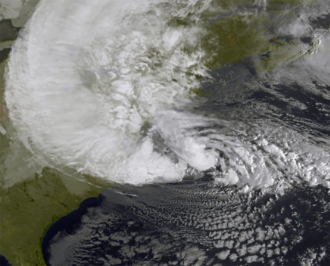
A tropical cyclone is one of the few major hazards that responders can usually see coming. Satellites pick up the disturbance days before landfall, models plot its likely path, and coastal authorities have time to act. Yet cyclones still kill and displace people in large numbers, because seeing a storm is not the same as knowing exactly where its worst winds, rain and surge will land, or getting everyone at risk into a safe building in time.
This article looks at how cyclone tracking has changed in recent years and what that means for the other half of the job: running shelters that keep people safe when the storm arrives.
What modern cyclone tracking can and cannot tell you
A layered observing system
Forecasters build their picture of a storm from several sources at once. Geostationary weather satellites provide continuous imagery of cloud structure and cloud-top temperatures every few minutes. Polar-orbiting satellites carry microwave sensors that see through cloud to the rain bands and eyewall beneath. Scatterometers estimate surface wind speed and direction over the ocean. Where agencies operate them, reconnaissance aircraft fly directly into the storm and drop instruments called dropsondes, which measure pressure, temperature, humidity and wind on the way down to the sea.
At the surface, moored buoys, drifting floats and, increasingly, uncrewed ocean drones record wave height, wind and the heat content of the upper ocean. That last measurement matters because warm, deep water is the fuel that lets a storm strengthen.
Track has improved faster than intensity
Track forecasts have become far more accurate over the past three decades, thanks to better observations, more powerful computers and ensemble modelling, which runs a model many times with slightly different starting conditions to show the range of plausible paths. Intensity forecasting has been harder. Rapid intensification, where a storm’s winds increase sharply within a day, remains one of the toughest problems in operational meteorology, and it often happens close to the coast. A storm that was expected to make landfall as a moderate system can arrive far stronger, leaving less time to scale up the response.
For practitioners, the lesson is to plan against the forecast cone and the upper end of the intensity range, not the single most likely line on the map.
Hazards, not categories
Wind category is the headline number, but water is usually the bigger killer. Storm surge, the rise in sea level pushed ashore by wind and low pressure, can flood coastal communities kilometres inland, especially in shallow bays and river deltas. Heavy rain from slow-moving or weakening storms then adds inland and flash flooding days after the winds have eased. Modern warning services increasingly issue separate surge, wind and rainfall products. Emergency plans should mirror that split, with evacuation zones drawn mainly around surge depth rather than wind speed alone.
Turning forecasts into decisions
Good tracking data only helps if it reaches decision-makers early and in a usable form. Three practices make a measurable difference:
- Decision timelines tied to forecast milestones. Agree in advance what happens at 120, 72, 48 and 24 hours before expected landfall: when shelters are opened, when ports and schools close, when evacuation becomes mandatory.
- Impact-based warnings. Messages that say what the storm will do, such as “surge of up to three metres along this stretch of coast”, prompt action more reliably than a category number.
- Clear zone maps. Residents should be able to look up their evacuation zone long before a storm forms, and know which shelter serves it.
Bangladesh and the Indian state of Odisha show what this approach can achieve. Bangladesh’s Cyclone Preparedness Programme, launched in the early 1970s after a catastrophic storm, relies on tens of thousands of trained volunteers who spread warnings door to door with megaphones and flags and help families reach shelters. Odisha rebuilt its system after the 1999 super cyclone killed around 10,000 people, and has since moved more than a million people out of harm’s way ahead of major storms such as Phailin in 2013 and Fani in 2019, with loss of life a small fraction of earlier disasters. In both cases the technology mattered, but so did the last mile: trusted local people carrying a clear message.
Shelter management: where plans meet reality
Location and structure come first
A cyclone shelter has to stay above the credible surge level and stand up to extreme winds. Purpose-built shelters in Bangladesh, for example, are raised on columns so that surge water can pass beneath, and newer designs supported by the World Bank are built to withstand winds of around 260 kilometres per hour. Where shelters use existing buildings such as schools, sports halls or community centres, each one needs an engineering assessment, not an assumption that a large building is a strong one. Windows, roofs and backup power are the usual weak points.
Design for everyone who will use it
People are more likely to evacuate when they trust that a shelter is safe and decent. Experience from coastal South Asia shows that separate toilets and private spaces for women, ramps for older and disabled people, and space for livestock all increase uptake. In many countries pets are a similar issue: owners who cannot bring animals often refuse to leave. Shelters should plan for medical needs too, including people who rely on oxygen, dialysis or refrigerated medicines.
Run it like an operation
Once doors open, a shelter is a small town that needs management. Key functions include:
- Registration of every arrival, so families can be reunited and responders know who is where.
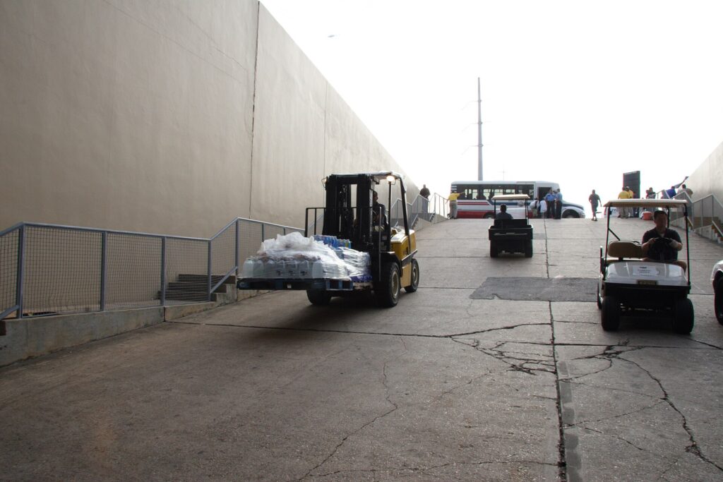
- Stock of water, food, bedding, hygiene kits and first-aid supplies for at least 72 hours, with a resupply plan that assumes roads may be cut.
- Backup power and communications, including satellite phones or radio if mobile networks fail.
- Health and sanitation monitoring to stop disease spreading in crowded conditions.
- Safeguarding procedures and trained staff to protect children and other vulnerable people.
- A named shelter manager with authority to make decisions without waiting for central approval.
Use technology where it helps
Digital tools now support shelter operations. Live occupancy dashboards help emergency operations centres direct evacuees away from full sites. Barcode or app-based registration speeds up intake and family tracing. Geospatial platforms combine forecast surge maps with shelter locations, road networks and population data to spot gaps in coverage before the season starts. The key is to keep a paper fallback for every digital process, because power and connectivity are often the first things a cyclone takes away.
What enterprises should do before the season
Ports, factories, logistics hubs, hotels and telecom operators along cyclone-prone coasts carry their own exposure. Risk teams can take practical steps now:
- Map every coastal site against official surge zones, not just general flood maps.
- Set trigger points linked to official forecast milestones for shutting down operations and releasing staff.
- Agree where staff and their families will shelter, and whether company buildings can safely serve as refuges.
- Secure fuel, water and generator capacity for critical facilities, and test it.
- Coordinate with local authorities so that company plans do not clash with public evacuation routes.
- Rehearse a scenario in which a storm intensifies rapidly and the decision window halves.
Key Takeaways for Practitioners
- Cyclone tracking now blends satellites, aircraft reconnaissance, ocean sensors and ensemble models, giving several days of useful warning.
- Track forecasts are far more reliable than intensity forecasts, so plan for rapid intensification near the coast.
- Storm surge and rainfall, not wind alone, should drive evacuation zones and messages.
- Tie every major action to a forecast milestone and pre-authorise it.
- Last-mile warning through trained local volunteers is as important as the forecast itself.
- Shelters must sit above surge levels, withstand extreme winds and meet the needs of women, older people, disabled people and those with animals.
- Manage shelters as operations, with registration, 72-hour supplies, backup communications and a clear manager.
- Use digital dashboards and geospatial tools, but keep paper fallbacks for every process.
The next article in this series moves inland and uphill, looking at how geospatial intelligence is used to map landslide susceptibility and manage unstable slopes.